Summit Chief - North Face
April 17-18th, 2004
To begin with, Colin and I's friend Joe Catellani clued us into to this
feature earlier this winter. He had known about it for some time, but
graciously "passed the torch" and provided us with the pictures
and motivation to make the trek back to the deep confines of the Middle
Fork valley. Thanks again Joe!
So with an iffy weather forecast, Colin and I left Seattle around 5 a.m.
As we turned onto the Middle Fork road it began pouring rain. Was it worth
it? Should we just bail to the Enchantments?? You never get anywhere without
trying, so we committed to the 2+ hour drive up the road. A combination
of Colin's slow determination and the tiny amount of clearance of his
Subaru brought us to the drivable end of the road. Seeing as we were still
about a mile from the trailhead, we broke out the mountain bikes and started
up the road.

Biking up the Middle Fork road.
The approach went fairly smoothly. We biked along until
the road became snow-covered, and then we followed the trail along the
valley bottom until it too petered out into snowy, open forest. The only
hangup, which we knew would be a challenge, was crossing the Middle Fork
river. High up in the valley it splits into several branches, the first
of which is the trickiest:
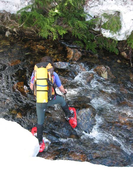
Colin tries a dubious river crossing.
After some searching we found a place to hop across on rocks.
Good thing too, as if we'd continued about 100 yards up valley we would
have used the bridge the trail goes over... what poor style that would
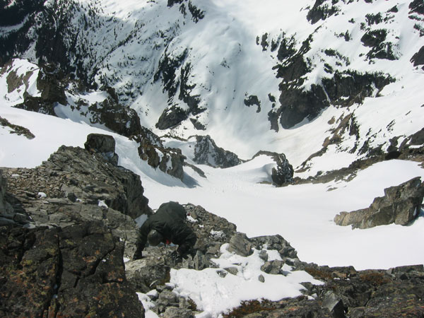
have been! We traversed up the steeper slopes of the South side of the
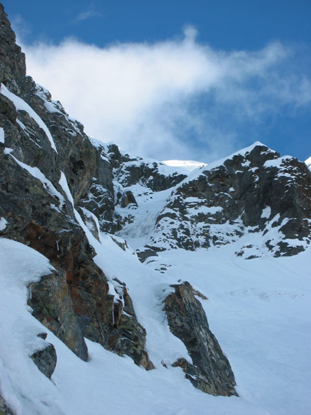
valley, and much sooner than we expected, the face came into view.

Our first view of Summit Chief's North Face.
Wow, what a sight! We immediately started chatting about
route options as the conditions looked excellent. The aesthetic series
of runnels and couloirs just right of the summit eventually looked like
the best route for us, so we cruised up the valley to setup camp. In total,
it took about 6.5 hours from the car.

Colin and I's route that we completed the next day.
An early start saw us climbing up the avalanche cone below
the face at around 6 am. The snow that had fallen on and off all night
had stopped, and it looked like a beautiful day was in store.

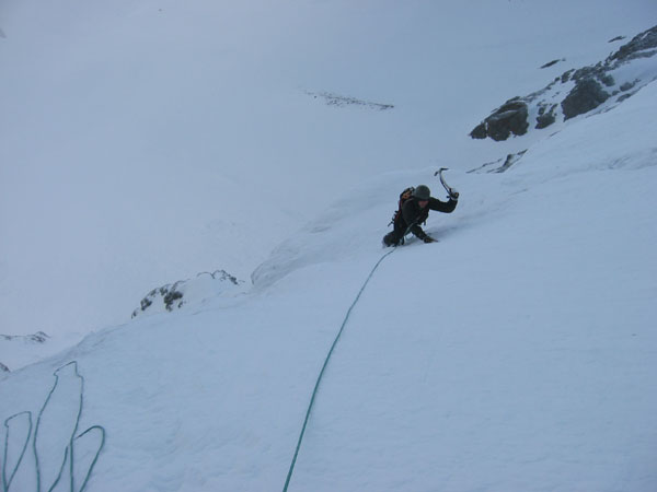
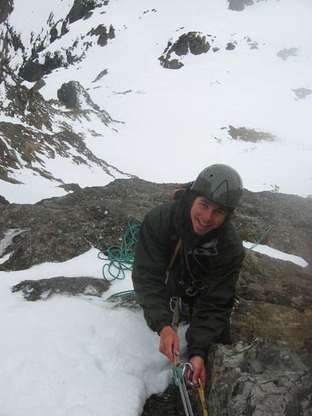
Starting perfect neve on the lower face.

Leading into the first of the ramp pitches.
The "ramp" feature, a slope that looked to connect
to the first snowfield, ended up being about 600 vertical feet of WI 2
and 3 water ice. Colin commented on how he'd never seen so much ice on
an alpine climb in the cascades. It was around then that we realized our
rack of two titanium (aka "afterthought") ice screws and much
rock gear might have been a little inappropriate. We made due though with
the odd knifeblade in the compact rock, and carefully rationing the screws.
Colin topping out on a steep section.

Another beautiful WI 3 pitch leads up into the first snowfield.

Way up on the first snowfield. The weather was unsettled but showing signs
of improvement.
Looking up the second snowfield towards the exit step.
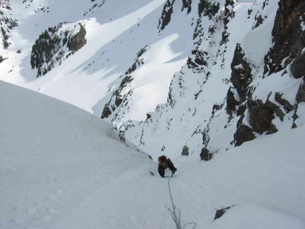
Colin finishing up the exit step (AI2).
Ahhh, into the sun! Colin scrambling to the summit.

Happy to be half way done on top of Summit Chief.
We relaxed just below the top, ate some food, and then headed
down the unknown SW side of the peak. Joe had sent us a picture of this
aspect of the mountain, and we both recalled something about a snow gully
with some rappels to do. Sure enough, the the gully on the far right (when
descending) ended up being just that. We downclimbed neve and made two
30m rappels to just touch down on the snow that leads to a col West of
the peak.
Rapping down the cliffy section of the Southwest gully.
The weather had closed in and it started dumping snow. We were glad to
be on the way down!
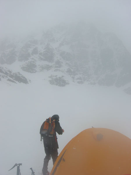
Back at camp we watched the spindrift avalanches rip down the face.
Time for the long slog back to the car...
From what is published and what Joe knew about the peak, we believe that
our route was the first climb of the North Face. In total the route is
around 2000ft high, and according to Colin, is comparable in scope to
the August 1971 route on the North Face of Dragontail. Regardless of the
history, it was a great climb, for sure the nicest alpine snow/ice
climb
I've ever done. Thanks Colin!
|