Three Fingers - Northeast Face
February 3rd, 2007
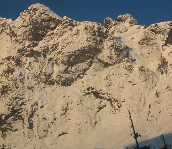
At last! The idea for this climb started, as many a good one has, with a beautiful photo by the prolific John Scurlock:
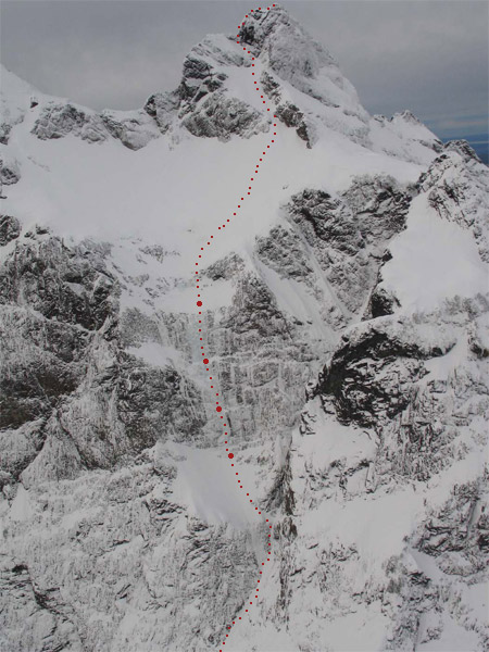
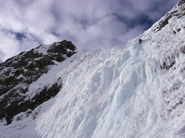
The Northeast Face of Three Fingers (Burdick/Frieh). Photo: John Scurlock
The East face of Three Fingers is located at the head of the Squire Creek Valley, just outside of the town of Darrington. A small dirt road from the edge of town heads up into the hills and leads to a trailhead right before a large washout. The steep and imposing face rises 2,000ft to each of the three summits from its base. It has seen only a little climbing activity aside from the East Face Couloir.
Round 1 was a failed day trip with Keith and Micah back in March 2006. A long approach with sloppy snow and then thin conditions on the crux pitch had the three of us bailing in the dark.
Round 2 (aka the Squire Creek Work Party), with Pax, Keith and John. Getting to the trailhead required some effort.
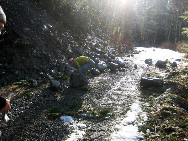
John, Pax and Keith clear the road while I sit atop my chariot.
This time we approached up the valley on firm snow all the way into the basin under the East face of Three Fingers. This approach is far superior to the route described in the Beckey guide for the Northeast buttress route. We arrived in about 3 hours from the car with light overnight packs.
Stoked! Cold... but stoked!
Spooky avalanches in the early morning darkness turned us around near the base of the route. Given John and I's track record over the past couple seasons, we felt like this:
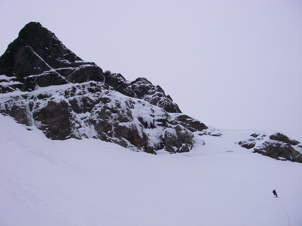
Looking back up later that morning the face was tantalizingly close. We could tell which of its three fingers the mountain was giving us.
The Northeast Face of Three Fingers in the morning.
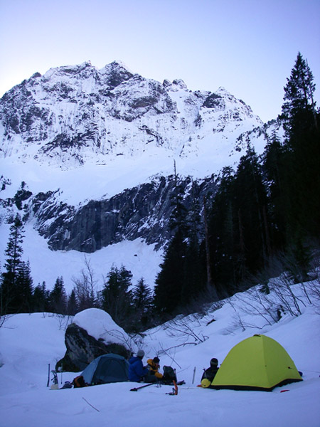
Fast forward to the next weekend. John and I bivi at the trailhead with bellies full of mexican food, and I make sure to bring earplugs. We leave the car at 2am under crisp clear skies.
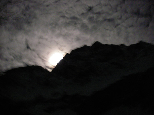
The moon setting over the mountain. Photo: John
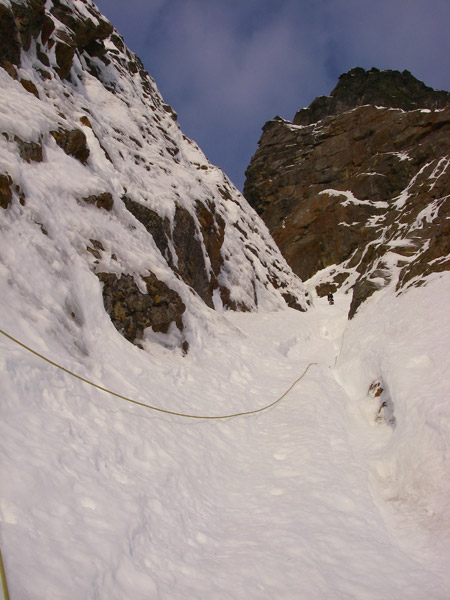
We blaze our way into the basin in a couple hours and head up toward the couloir that breaches the lower cliff band in the cirque. It's worth noting that of the two gullies that look like they will breach this section, only the one on the right with trees in the middle of it actually connects.
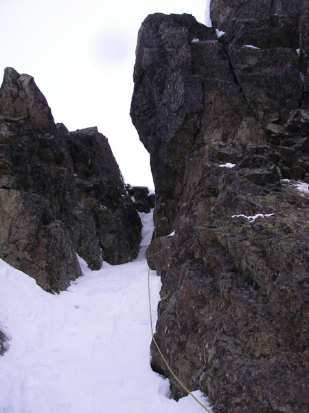
We reach the base of the route and begin climbing around 7:30 or so. Conditions are perfect and I take the first lead up the entrance to the couloir (WI3). I'm smiling like a goofy idiot when the sun comes out and bathes the beautiful iced couloir around me with warm pink light.

The first pitch into the couloir. Photo: John
Running the belay up the couloir.
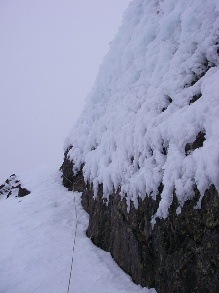
We simu-climbed for three or four rope lengths of moderate snow and ice up the couloir until we reached the basin below the crux tier of ice. John racked up and sent the crux of the climb leashless and with excellent style (WI4+, 60m). The ice was fat, blue and plastic!! I took the next two pitches which continued with more fantastic water ice (WI3+, then WI4) . Each pitch was 60-70 meters in length, making the whole tier roughly 600' tall.

John leading the crux (WI4+).
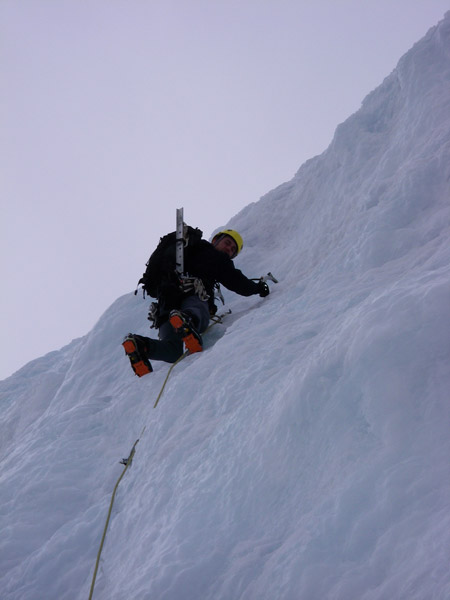
Dave starting the second pitch of the tier (WI3+). Photo: John
Looking down. Photo: John

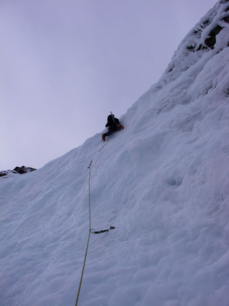
Starting the 3rd and final pitch of the tier (WI4). A beautiful and long
pitch to the snowfield above. Photo: John

Above the ice is a low angled snow bowl below the North Summit. I brought John up and we began slogging. Once I neared the ridge crest below the north summit, I found a perfect little mixed chimney that lead to some moderate rime ice.
Heading towards the North Summit. Photo: John
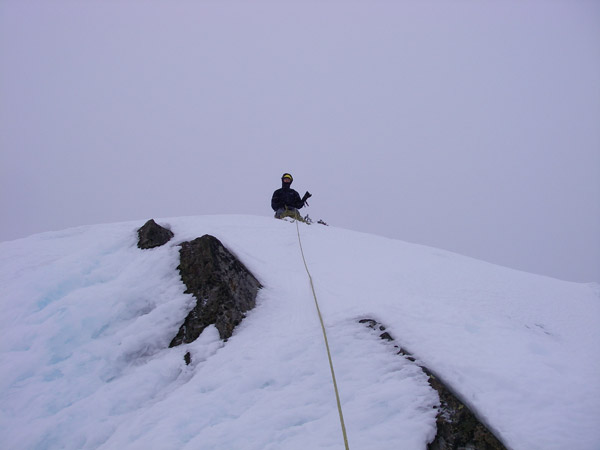
On top!
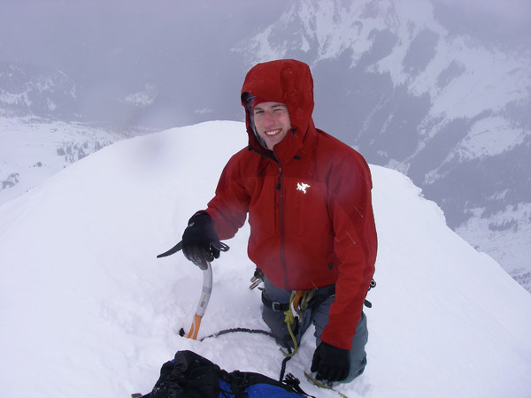
John working on his tan.
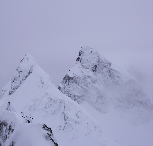
Looking out towards the Middle and South peaks.
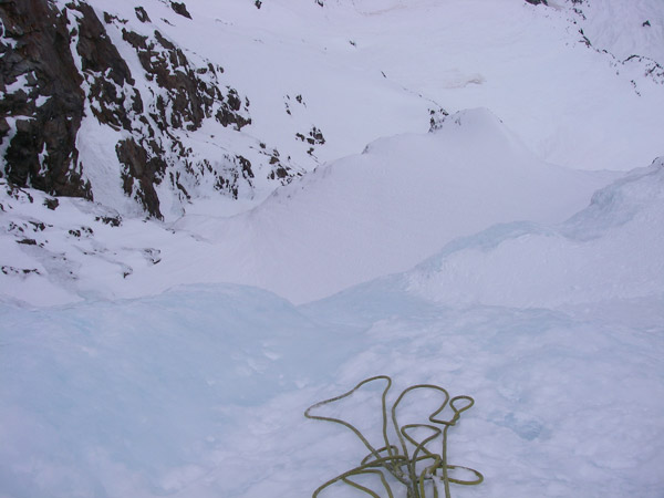
The nice clear weather that had held for the past two weeks came to an abrupt end while we were on the summit. We booked it down to the NE shoulder below the North summit and crossed over onto the descent just in time for a little Marco Polo.
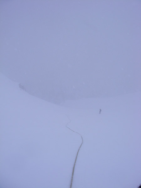
Climbing by braille.

Thankfully we had this picture which shows the descent down the North
face.
We traversed back under the East face and with a little wandering around we found the gully leading back down to the valley below.
We carried 11 ice screws, some screamers and a light rock rack (placed a couple nuts, a .75 and a #1 Camalot). We also used a single 70m rope.
Thanks for a wicked climb John!
More detailed approach info
Drive to Darrington and take the Squire Creek Road out of town (it's near the west end of town). There are essentially no turns off the main road so it is easy. Drive up some switchbacks until you are traversing the left hand side of the valley. About a mile before the trailhead there is a small land slide over the road. You could probably 2WD over this if you brought a shovel to smooth things out a bit. There are some small (3") downed trees on the road ahead, but nothing that you couldn't wheel over.
From the washout trailhead, hike along the closed road. Once across the washout look to climb up to the old road bed. Follow the road to the old trailhead, passing the Squire Creek Wall along the way. Simply follow the trail until it meets a creek (marked on USGS) before the trail begins the climb up switch backs towards Squire Pass. Drop down to the valley bottom and follow the river about another 30 minutes up valley (no brush at all!). You'll enter a clearing where you can see Three Fingers's East Face. Go to the river and cross on logs. Follow the dry creek bed up towards the basin under the East face. It takes 2 to 3 hours to get here from the car.
Hike towards the middle of the basin and ascend a narrow and steep couloir that breaches the cliff band in the cirque. There are some obvious trees that mark this couloir. Once above the cliff band, traverse right to the base of the route.
To descend, find the shoulder between the North summit and the Northeast Buttress route. This leads to the North face. Descend while keeping left, easy walking, until you reach a steeper couloir at the bottom. It necks down but there is no need to rappel in the conditions we found. This puts you down at the Craig Lakes.
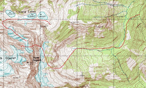
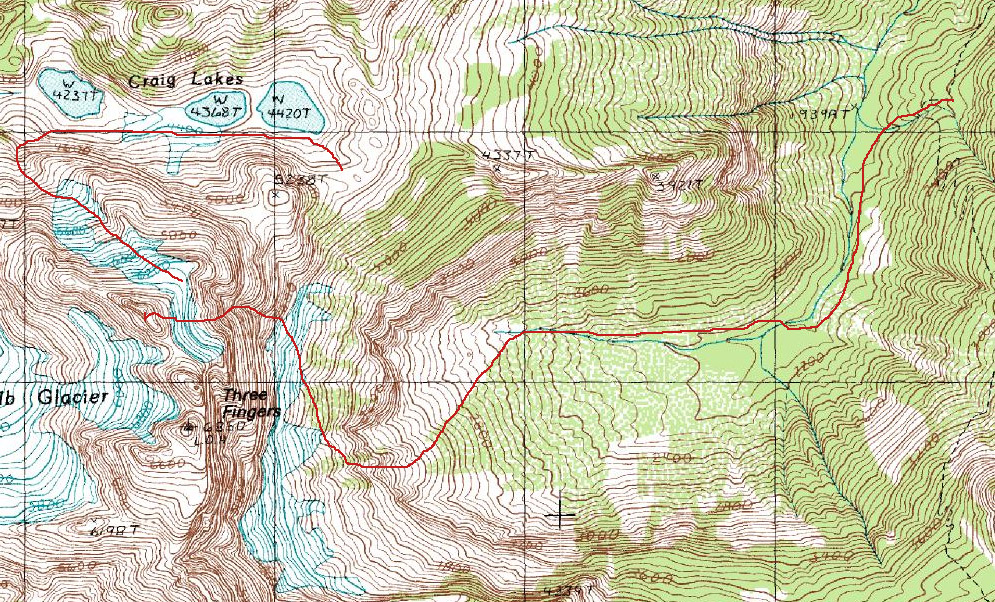
Map of the approach, climb and descent. Click for a larger version.