Where is here?
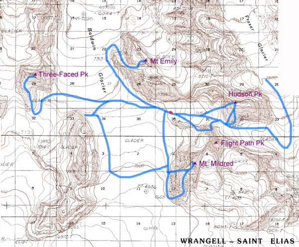
The St. Elias Range runs from the roughly Chitina River south to the ocean, and East into Canada, near Mt. Logan. This is all located where Alaska turns into the Pan-handle and runs down along the coast mountain ranges. Below is a map that Phil made of the area from the "Barring Glacier 1:250,000" USGS map.

Map of the Bagley icefield and our route, by Phil Fortier.
Camp was located in a side valley that gave us great wind protection from the usual gale in the valley of the icefield. Being at 8,000 ft. was also an advantage, for the frequent fogs that would roll up the valley stopped not more than 200 feet below our camp. Thanks Paul for sticking us in the sunshine! In fact, over the whole trip, we had two days with measurable precipitation (one graupple once rain!), and one day of really strong winds. Pretty posh for any range! Aparently Alaska recieved 1/3 of its normal percipitation this year during the month of June.
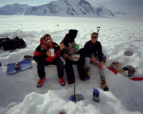
The local Bistro was quite good, as Marcus indicates! Mmmmm... MountainHouse
Photo: Phil Fortier
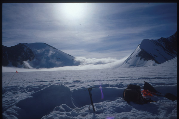
The mountains here were very predictable in some respects. The North Faces were always steep, glaciated and covered in icefalls or big schrunds. West faces were most always glaciated, and they had the longest frozen spell on any given day we were there. Generally, the sun would peak over onto the West side of the peaks around 8:30 am, and often set off them around 10 pm. In contrast, the East faces often recieved first sun (4 am), and continued to get baked until about 7 pm when the sun would give them some shade. East faces were pretty scary, unpredictable beasts. Our initial thoughts on climbing Two-Face Peak were to climb it by it's steep East side. However, after watching massive avalanche after avalanche tear down the face, we changed our plans. The South aspects tended to be melting, or melted out scree and snowfield slopes. Seeing as the rock in the range is some sort of diorite/shale consistancy, there were no appealing rock climbs on these loose faces. The South gullies also tended to be the biggest avalanchers. Climax slides would rocket down the slopes all day long, while the sun warmed the crust off of the iso-thermal snow/slush. This is how "Thunderbunny Peak" got its name (an unclimbed peak just North of basecamp). As we skied over to Two-Face in the clouds, Thunderbunny spit avalanches almost continously all day long.
Hudson Peak and Offcourse Peak.
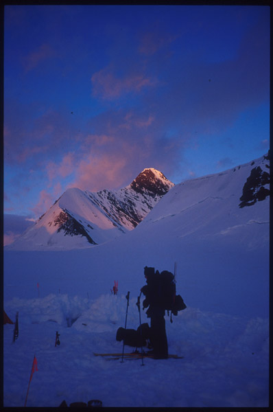
Flightpath gets some Alpenglow.
Paul Claus seemed like he really wanted us to climb Flightpath Peak. The NE face ice climb he mentioned looked really steep and cool, but there seemed to be no aparent easy descent. This wasn't too good, seeing as we'd have to descent a) a threatened face or b) a steep rotten rock ridge to get off the peak. Thus, we mostly wrote off Flightpath. Unfortunately, on our 2nd to last day on the glacier, we spotted an easy looking snow gully leading down the Southeast side. Alas, we could have done it, but such is climbing in the mountains...
Below is a map Phil modified to shop all of our routes around the local area. Base camp is the red dot near the middle.