The Bugaboos
September 6-9, 2002
At long last, a trip to the Bugaboos had materialized. Chris and I had laid down plans for an early September trip, when he could scam a few extra days away from his research. We left Seattle around 1:30 pm Friday afternoon, intent on making the drive northward through Canada.
We stopped for food and spirits in Hope, and were happy to find them right next door to each other. We had forgotten any sort of Nalgene flask, so we took our time pondering the different plastic-bottled liqueurs in front of us.
"Hmmm... Special Reserve Canadian Whiskey. Special Reserve Canadian Bourbon..."
Maybe Special means it comes in a plastic bottle. We opted instead to suck it up and carry a glass bottle of Jagermeister.
With an hour for dinner, we arrived at the turnoff of 95 from Brisco at around 1 am. Driving past the saw mill we spotted the first sign towards the Bugaboos. Yee-haw. Down the road we go, nervously looking at the antiquated map in the guidebook. We meet the junction of "Brisco - West" and "Westside Rode" and take a wrong turn onto the Westside Road. Flying down the road away from the junction we soon meet the highway again. What the hell?! So we turn around, and proceed to drive 18 K up another wrong road which soon turns to a private but openly gated road ("Old mine road", or some such thing). We have been lost for the duration of Floyd's Dark side of the Moon, and a bit into the next CD. We reread the driving directions and figure that we must have missed a "small sign to the bugaboos." Sure enough, right at the intersection with the Westside road, there is a tiny little sign on the left (coming from Brisco) that says "Bugaboo". This is at exactly 5 Km from the road start in Brisco. There is also a big yellow sign for the CMH helo lodge telling you to take a LEFT!
Soon we get to a road with yellow plastic Km signs and drive the remaining 38Km to the parking lot. Chris tried to sleep this leg for I was driving quite fast at the worse-than-they-look potholes. The road is actually quite good, and we only bottomed out once! We arrived at 2:45 am.
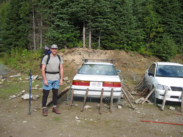
Chris and the car, protected from those darn varmits! (porcupines)
I slept in my bivi sack and it rained all night long. We woke us to mixed skies and snow dusting the hills above. After packing up and eating a luxurious breakfast of corn and honeydew, we headed off on the infamous trail to the Kain hut.

Chris on the trail as Hounds Tooth and Snowpatch Spire come into view.
The trail was smooth and easy heading up towards a cliffy section just below the hut. Here there are steal cables installed and a ladder to help you surmount the rock sections. We met several parties coming down the trail with bad news: the major climbs of the spires were plastered in snow and ice, and few had succeeded in even attempting them. However, we met one fine gentleman who informed us that they had "Climbed everyday, despite the weather. And you know, some good technical stuff." Just under two hours from the car, we reached the magnificent Kain Hut.
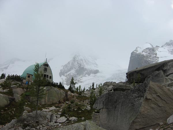
The kain hut is a "Class A" hut run by the CBC alpine club.
The hut totally surpassed our expectations. There was electricity from a mini hydroelectric setup, gas stoves, foam mattresses, and a huge public area. We were also quite taken by the "Free nonperishable food" cupboard of abandoned wacky foods!

Inside the Kain Hut.
We now had hopes of climbing something, but a slight Bugaboo interrupted our plans:

A typical Bugaboo flash-snowstorm.
It dumped snow for two hours, sending all the occupants of the hut down from their climbs. Chris and I settled back and read our books for a few hours. Sure enough, the snow stopped, and the sun came out and began to melt it away. I woke Chris up, and we decided to scramble up Eastpost Spire. We brought the ropes and gear along, incase we wanted to do some "good technical stuff".
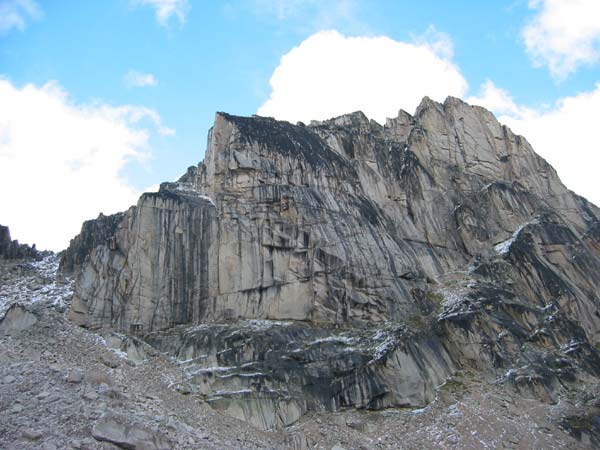
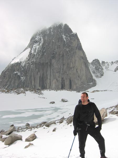
Eastpost Spire from Applebee Dome.
A quick hike up the moraine to Applebee Dome leads to the scree below the notch in Eastpost's NW ridge. We took a quick look at the West Face route (II 5.8) and saw that it was nothing more than a 1-2 pitch variation up a low 5th loose gully. Perhaps there is a 5.8 route with some major contrivance, but we opted to scramble up from the col just above.
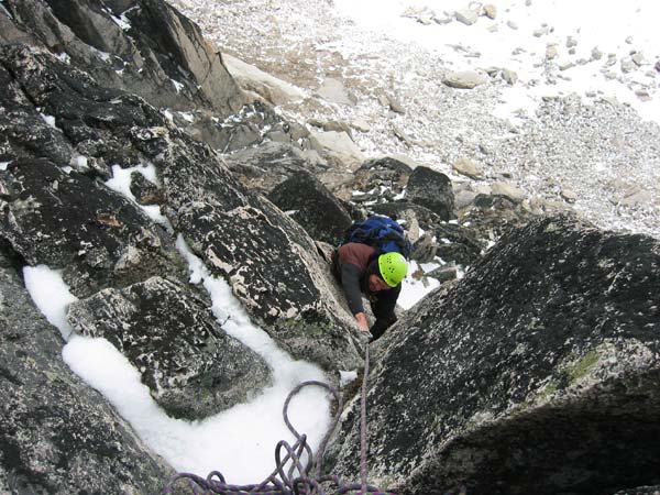
Chris on a dry part of the NW ridge.
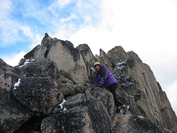
The ridge had about 3" of snow on it, making the otherwise easy scrambling a little tenuous. Higher up on the ridge we could see the steep South Face, and all the Gendarmes that dot the crest. We contoured around to the easier North side and scrambled up snow and rock to a notch in the NE ridge. From here, a short 4th class "crux" of the route leads to the summit.
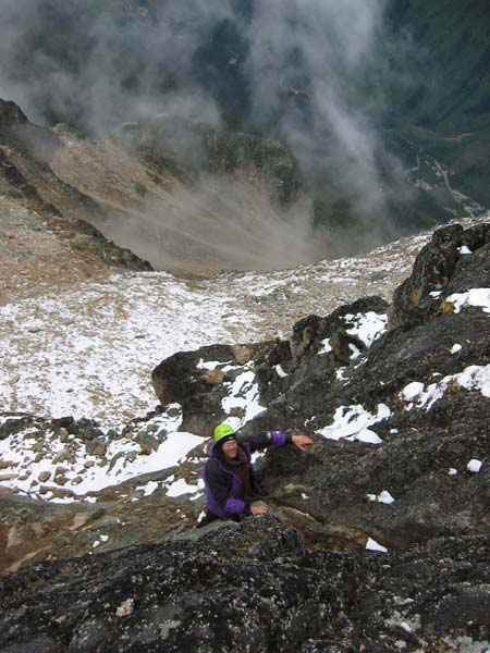
Chris climbs to the summit.
After downclimbing the ridge, we setup at the base of a little South facing crag on the other side of the Col. At least three beautiful cracks shot up the steep wall, so we picked one and Chris let me have the first lead. It was snowing lightly. I chose a nice (.10ish) overhanging hand crack that lead to the lower-angled wall above. However, after getting up half the route, the snow began dumping down, melting as it hit the rock. Suffice it to say, I bailed!
Too much snow today!
After snowing all night, the next day's the weather was supposed to be 30% chance of rain (snow). We took a leisurely morning of eating and reading, and left the hut around 10:30 am for the Crescent Towers area. These towers (and Spire) are lower elevation than the other spires, and face South. They are the first to melt and dry off, and are great for when the weather is iffy. There are three towers (North, Central, South) and the spire which is known as the McTech Arete area. We had decided to try either Lions Way (II 5.6) or Tiger's Trail (II 5.9), both of which surmount the Central Tower.
Chris and Snowpatch Spire, on the way to the Towers.
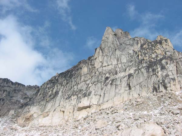
The Crescent Towers. Lions way starts on the far left side of the face.
The weather had improved quite a bit by the time we reached the base of the climb. We spotted Tiger's Trail, but it was wet and pretty dirty. So we kept on until we were under Lion's Way. We roped up on a nice ledge below the initial wall, and Chris lead off under mixed clouds and snow flurries.

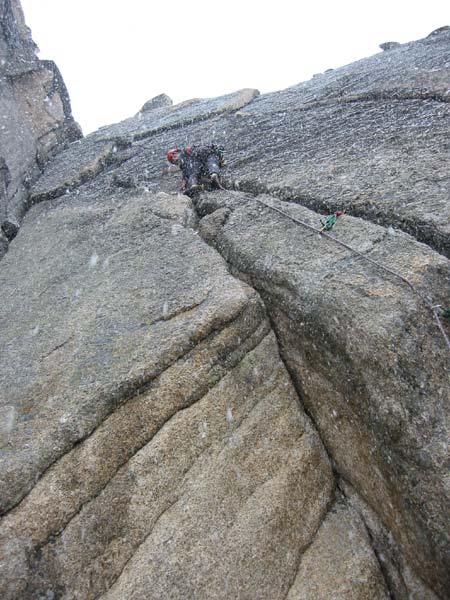
Chris leads the first pitch.
It was COLD! Chris's hands froze right away, and I sat shivering in all of my clothes at the belay. Instead of following the topo's "pitches", Chris continued on and combined the first 2.5 pitches with our 60m rope. I followed up, and found out why Chris had taken his time on the "second" pitch according to the topo. This section is rolly climbing with few positive holds and just happened to be totally wet and iced up. Quite lovely, really!
Once I regained feeling in my hands, I lead off on a series of ledges that were broken by steep walls. This lead to the crux 5.6 hand crack in a nice little inside corner. Perfect jams and solid rock lead up to a big ledge and a comfy belay.
Chris follows the splitter handcrack.
The weather seemed to be improving a bit with some sunshine finally hitting us. However, it remained cold and there continued to be a mysterious light flurry of snow coming down.
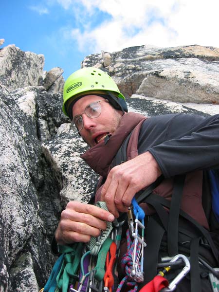
Chris's face says it all as he prepares for the next lead.
Another two pitches of fun low 5th and 4th class terrain with a couple harder moves lead to a bench below the summit.

Dave leading on our pitch 4.
A short pitch up the face of the summit pinnacle put us both on top a short time later. We relaxed in the sun, tried to warm up, and enjoyed a well deserved lunch. Unfortunately, the sun soon became shrouded in clouds and the temperature again dropped. I measured it to be about mid-30's (F) with my watch's thermometer. The view, however, was spectacular!

Bugaboo Spire and its very snowy NE Ridge (right-hand skyline).

Pigeon Spire as seen through the Snowpatch-Bugaboo Col. The West ridge
is the right hand skyline.
We downclimbed scree ramps and some 3/4th class terrain down towards the NW Gully. Below us the wall quickly steepened, and we spotted a well setup rap station. A single rap bypassed some icy 4th class section and deposited us on easy ground in the main gully between McTech Arete and the North tower.

Chris headed back to the hut for a spectacular dinner!
Taking full advantage of people bailing out due to weather, we graciously used their fresh vegetables and pine nuts to make a great dinner. The next day we had resolved ourselves to waking up early to give the Kain route on Bugaboo spire a try. Two guys had forced their way up a few days earlier, needing to tension across the crux slab because it was all iced up. However, the forecast gave us a glimmer of hope.
The alarm went off at 4 am and was accompanied by the pitter patter of rain on the hut roof. Outside a winter wonderland revealed itself. This was welcome news at that hour, as well as at 5 am when the alarm woke us again. Chris had the following to say 'bout this:
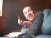
Quicktime
Movie of Chris in the Kain hut. (239 Kb)
We ended up just reading and sipping Tea until packing up and heading out around midday. It took a mere hour to hike back to the car. We decided to drive back through Idaho and Washington's I-90. This worked out great, and put us home in only about 10 hours!
We'll be back next year... earlier though! :)