Glacier Peak - Sitkum Glacier

Glacier Peak from a distance.
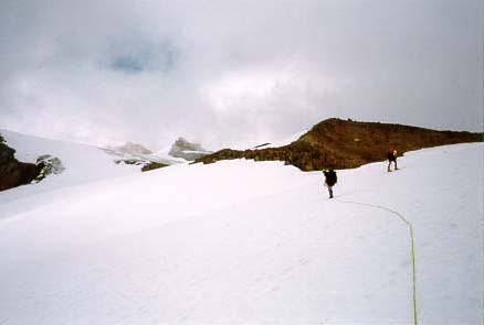
From Boulder Basin, ascend snowfields that turn into low angled glacier to the ridge crest. Follow this ridge left along intermitant pumice and snow fields until you reach a large abalition zone of the above glacier. Here there are two options. The standard route follows a thin line through the blue ice of the abalition zone. The route is straitforeward beforehand, but caution must be taken on the hard ice. An alternate route is to traverse left and down onto the main Sitkum Glacier. This somewhat steep gully (c. 30 degrees) leads up past small cracks to a obvious pumice col. (9000 ft). Sitkum Spire marks this notch where a party may unrope if they see fit. Follow this pumice ridge up for about 1000 feet to where terrain permits a traverse onto the north side of the mountain. Traverse left across snow and rock bands until the slope steepends and you nearly under the summit. Climb up to the summit ridge and figure out where the summit is this year. Note, in some conditions, a icy summit pyramid may represent the summit. A rope and srews are advised for this climb.
Our only view of the route!
Time: One day to summit and back to PCT

Admire the view of the North Cascades!
Glacier was a neat mountain. It's remoteness meant very few people, and a true wilderness expirience. SCA trail crew included! We came into Boulder Basin camp at around 1pm, and decided an hour later to leave only out sleeping pads at camp, and shoot for the summit. Because of the time, we happened to have the mountain to ourselves. The accent was pretty strait foreward over some low angeled glacier, and then some steeper, 30 degree slopes, until we reached a col. at about 9,500 feet. Here we left the rope (and skis) and accended this pumice ridge for a greuling-foot-sinking thousand feet. Then we proceded to traverse around the back side of the mountain and up to the summit ridge. Apparently the "true" summit moves around yearly with the snows, and seeing as we wern't the Mountaineers, this white spot looked as good as any other. The descent was interesting enough, especially after leaving the summit at 7pm. Russel and Mike skiied down the glacier before Sanford and I. As we followed thier "tracks" down the decent route, we had to change course as thier tracks were leading us right over a bunch of small crevasses. After arriving at the bivi, and seeing as it was raining and we didn't have tents, we decided to decend the ridge to the Pacific Crest Trail at around 4,000 ft. I was a little less than happy to be decending the steep-ass "trail" down in the dark, but it was worth it that night for the tree cover. With a strong, fast group in good snow conditions, this is a great climb to do in the day. Supposidly with nice views! :)