Mt. Rainier
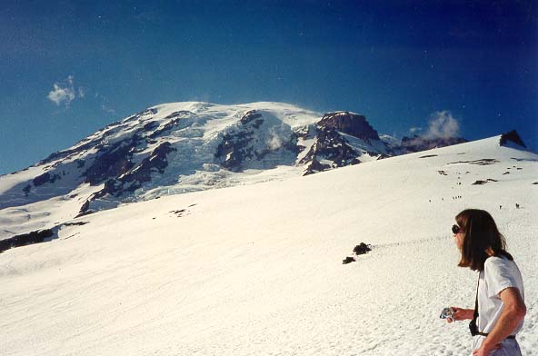
Mt. Rainier from the Muir snowfield.
Liberty Ridge
Furher Finger
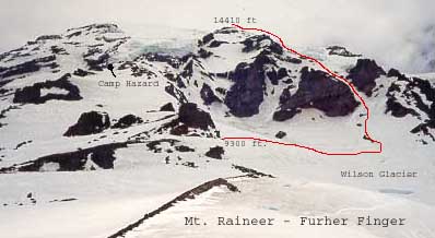
The route begins by crossing the Nisqually Glacier in the Glacier Vista area. Cross the glacier and climb the Nisqually Aparon between the two rock cliffs. Traverse right until a small headwall is reached. Climb this steep snow slope and follow the rock ridge above until it runs out onto the Turtle snowfield. Ascend this slope along the West side of the Wilson Glacier until some great bivi spots are reached along side the rock spurrs (c. 9300 ft). Cross the Wilson through a feasable line to the base of the fingers (some large crevasses). Climb up and left on the fingers until the couilors split. Take the left fork while keeping to the left on steeper ground (c. 40 degrees) to avoid the fall line. Watch for rock and ice fall, especially later in the day! Once a crest is reached, continue to follow the rock ridge until it dead ends at about 12,500 feet. Cross over rocks to one couilor West and ascent through a gap in the rock. Traverse across and then up steep slopes (c. 50-60 degrees) on the edge of the Nisqually for a short distance until another rock ridge is reached.
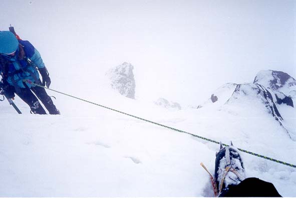
Climbing the steep step off the edge of the Upper Nisqually
Follow the upper Nisqually glacier to the crater rim and Columbia Crest. The descent is made down the Kautz Glacier Route. The enterance to this glacier is found at 13,000 feet at the top of the last rock ridge. Descend the Kautz route through the chute to camp Hazard. Note: If you descend on the wrong slope, one rock ridge East of the Kautz glacier, you will end up on the Wilson Headwall route. This is most obviously noted by the very steep snow and and rock cliff bands.

Descending the Kautz Glacier Chute
Kautz Glacier Route
Approach via the same as the Furher Finger, but at 9300 ft continue up the Turtle snowfield until you reach camp Hazard (11,400 ft.). This is a long hual for one day, so either move fast or camp down lower and consider a three day trip. Enter the chute by crossing the icefall a little lower than hazard. Then ascend the slopes, up to 40 degrees (icy in late season) to the lower angled Kautz glacier. This year (99) the Kautz was quite broken up, and we needed to go strait out of the chute and then contour right towards the Wapatowey Cleaver. We Followed the cleaver to 13,000 ft, then ascended Point Success and crossed over to Columbia Crest. Descending the route was easy and straitforeward except for the downclimbing of the chute.

Half dead, taking a break between Pt. success and the summit. Photo
by: Emily

Marcus, Benji, Emily and Dave on the summit!